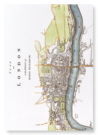
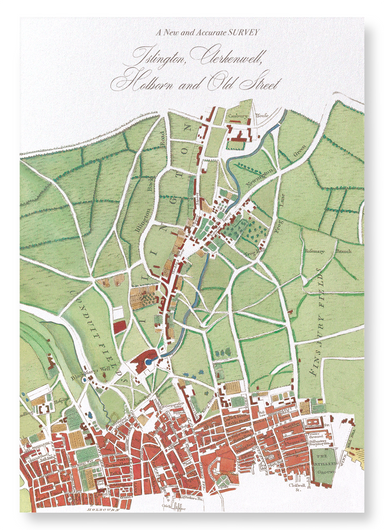
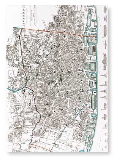
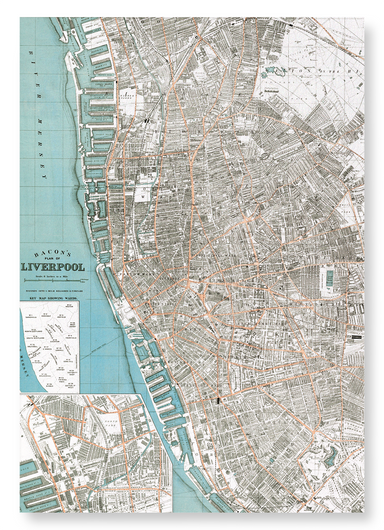
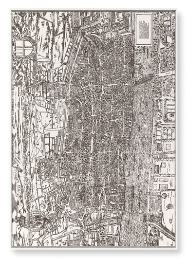
Skip to content

Map Antique Art Prints

  • Art Print

    LONDON (1827)

    from £20.00

    Map of London from an actual survey made between 1824-1826 by Christopher and John Greenwood. The city was the first to reach a population of over ...

    View full details
    from £20.00
  • Art Print

    LONDON BEFORE 1666

    from £20.00

    Image from an eighteenth century copperplate depiction of London, published by J.Cooke, London, in 1776. as it was before the great fire of London...

    View full details
    from £20.00
  • Art Print

    LONDON MAP (C.1580)

    from £20.00

    A map depicting Elizabethan London, which was a centre of entertainment and leisure activities. Inn-yards and the new theatres provided performance...

    View full details
    from £20.00
  • Art Print

    BRITISH ISLES (1760)

    from £20.00

    The antique copper engraving of the British Isles, created by Borde and published in Histoire Universelle around 1760, captures the geography of 18...

    View full details
    from £20.00
  • Art Print

    ISLINGTON MAP (1755)

    from £20.00

    By the cartographer William Maitland, the map was published as part of “The History and Survey of London”. This map shows the vicinity of Islington.

    from £20.00
  • Art Print

    PARIS IN 17TH CENTURY

    from £20.00

    View of Paris published c.1660 by Martin Zeiller. The city was founded in the 3rd century BC by Celtic people called the Parisii, from where the ci...

    View full details
    from £20.00
  • Art Print

    CELESTIAL MAP (1820)

    from £20.00

    Produced in London by Richard Brookes, the celestial map shows the constellations in the northern and southern hemispheres. The word "constellation...

    View full details
    from £20.00
  • Art Print

    DURHAM (1806)

    from £20.00

    A map of Durham from the publication The Beauties of England & Wales, 1806. The present city of Durham can be traced back to when a group of mo...

    View full details
    from £20.00
  • Art Print

    CITY OF OXFORD (1837)

    from £20.00

    Engraved by J.Cleghorn, the map was published in 1837 as a part of Thomas Moule's English Counties. Steel engraved by J.Cleghor, the decorative pla...

    View full details
    from £20.00
  • Art Print

    LIVERPOOL MAP (1650)

    from £20.00

    In 1650 Liverpool still consisted of its seven original streets, including Dale Street, Castle Street, Chapel Street and Water Street. Two years ea...

    View full details
    from £20.00
  • Art Print

    MAP OF LIVERPOOL (1851)

    from £20.00

    This steel engraving of Liverpool was drawn and engraved by John Rapkin and published by English cartographer John Tallis. The upper illustration, ...

    View full details
    from £20.00
  • Art Print

    MAP OF LIVERPOOL (1836)

    from £20.00

    Map of Liverpool published in 1836 by Chapman and Hall. Some of the most famous landmarks of the city are showcased in the lower part.

    from £20.00
  • Art Print

    LIVERPOOL MAP (1572)

    from £20.00

    Produced in the 19th century, this is a map of Liverpool reconstructed from unspecified “ancient sources”. Giving a fascinating insight into the fo...

    View full details
    from £20.00
  • Art Print

    CANTERBURY (C.1670)

    from £20.00

    A Ground Plott of Canterbury by Wenceslas Hollar, which was originally published around 1670. The copper plate engraving was taken from a strike of...

    View full details
    from £20.00
  • Art Print

    GLOUCESTERSHIRE (C.1840)

    from £20.00

    This antique map of Gloucestershire by Thomas Moule (1784 – 1851), contains vignettes of Gloucester Cathedral, Tewkesbury Abbey church and the New ...

    View full details
    from £20.00
  • Art Print

    ANTWERP (1832)

    from £20.00

    Published under the superintendence of the Society for the Diffusion of Useful Knowledge, this map is a view of “Antwerp from the road to Mechlin, ...

    View full details
    from £20.00
  • Art Print

    ANTWERP (1652)

    from £20.00

    Titled ‘Antverpia; Gallis Anvers. Vernacule Antwerpen.”, the map is by the Dutch cartographer, Joan Blaeu (1596-1673). The city of Antwerp is showi...

    View full details
    from £20.00
  • Art Print

    IRELAND (1665)

    from £20.00

    A map of Ireland published as part of the Atlas Major. Today, 80 million people of Irish descent are estimated to live outside of Ireland, which is...

    View full details
    from £20.00
  • Art Print

    FRANCE (1665)

    from £20.00

    France, including the islands of French Guiana, Guadeloupe, Martinique, Mayotte, and Réunion Island, is the largest country by size in Europe. Prin...

    View full details
    from £20.00
  • Art Print

    BRISTOL (1568)

    from £20.00

    Titled "Brightstowe, vulgo" was published in Cologne in 1588 in the book Civitates Orbis Terrarum (Towns of the World). The sheep showing in the ma...

    View full details
    from £20.00
  • Art Print

    DURHAM (1786)

    from £20.00

    A map of Durham published in Picturesque Views of the Antiquities of England & Wales, 1786. The entire centre of Durham is designated a conserv...

    View full details
    from £20.00
  • Art Print

    MAP OF SCOTLAND (1851)

    from £20.00

    A detailed 1851 map of Scotland, featuring an inset of the Shetland Islands, showcases illustrations of local landmarks and daily life. Scotland's ...

    View full details
    from £20.00
  • Art Print

    OXFORD (1806)

    from £20.00

    Engraved by J.Roper based on a plan by G.Cole, this copperplate printed mat was published in The Beauties of England & Wales in 1806. Numbered ...

    View full details
    from £20.00