
Skip to content

Maps

  • Art Print

    The print

    IRELAND (1665)

    from £20.00

    A map of Ireland published as part of the Atlas Major. Today, 80 million people of Irish descent are estimated to live outside of Ireland, which is...

    View full details
    from £20.00
  • Art Print

    The print

    FRANCE (1665)

    from £20.00

    France, including the islands of French Guiana, Guadeloupe, Martinique, Mayotte, and Réunion Island, is the largest country by size in Europe. Prin...

    View full details
    from £20.00
  • Art Print

    The print

    BRISTOL (1568)

    from £20.00

    Titled "Brightstowe, vulgo" was published in Cologne in 1588 in the book Civitates Orbis Terrarum (Towns of the World). The sheep showing in the ma...

    View full details
    from £20.00
  • Art Print

    The print

    DURHAM (1786)

    from £20.00

    A map of Durham published in Picturesque Views of the Antiquities of England & Wales, 1786. The entire centre of Durham is designated a conserv...

    View full details
    from £20.00
  • Art Print

    The print

    MAP OF SCOTLAND (1851)

    from £20.00

    A detailed 1851 map of Scotland, featuring an inset of the Shetland Islands, showcases illustrations of local landmarks and daily life. Scotland's ...

    View full details
    from £20.00
  • Greeting card

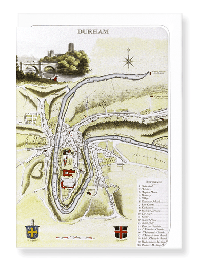
    Ezen Designs - Durham (1806) - Greeting Card - Front

    DURHAM (1806)

    £3.50

    Text on the reverse side:A map of Durham from the publication The Beauties of England & Wales, 1806. The present city of Durham can be traced b...

    View full details
    £3.50
  • Greeting card

    Ezen - Durham (1786) - Greeting Card - Front

    DURHAM (1786)

    £3.50

    Text on the reverse side:A map of Durham published in Picturesque Views of the Antiquities of England & Wales, 1786. The entire centre of Durha...

    View full details
    £3.50